File:Warcraft II - Map of Eastern Kingdoms.jpg
Jump to navigation
Jump to search


Size of this preview: 475 × 600 pixels. Other resolutions: 190 × 240 pixels | 713 × 900 pixels.
Original file (713 × 900 pixels, file size: 426 KB, MIME type: image/jpeg)
Summary
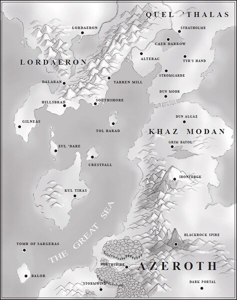
Eastern Kingdoms. Artwork by Stu Rose and Chris Metzen.[1]
- Locations
See File:Warcraft II - (Silent) Map of Eastern Kingdoms.jpg for a silent map.
_Map_of_Eastern_Kingdoms.jpg)
Source
Originally from the following manuals:
Licensing
This image is concept art officially recognized by Blizzard.
References
File history
Click on a date/time to view the file as it appeared at that time.
| Date/Time | Thumbnail | Dimensions | User | Comment | |
|---|---|---|---|---|---|
| current | 15:07, 5 October 2023 | | 713 × 900 (426 KB) | Xporc (talk | contribs) | == Summary == Testing if I can fix the picture's resolution |
| 12:56, 15 October 2016 | 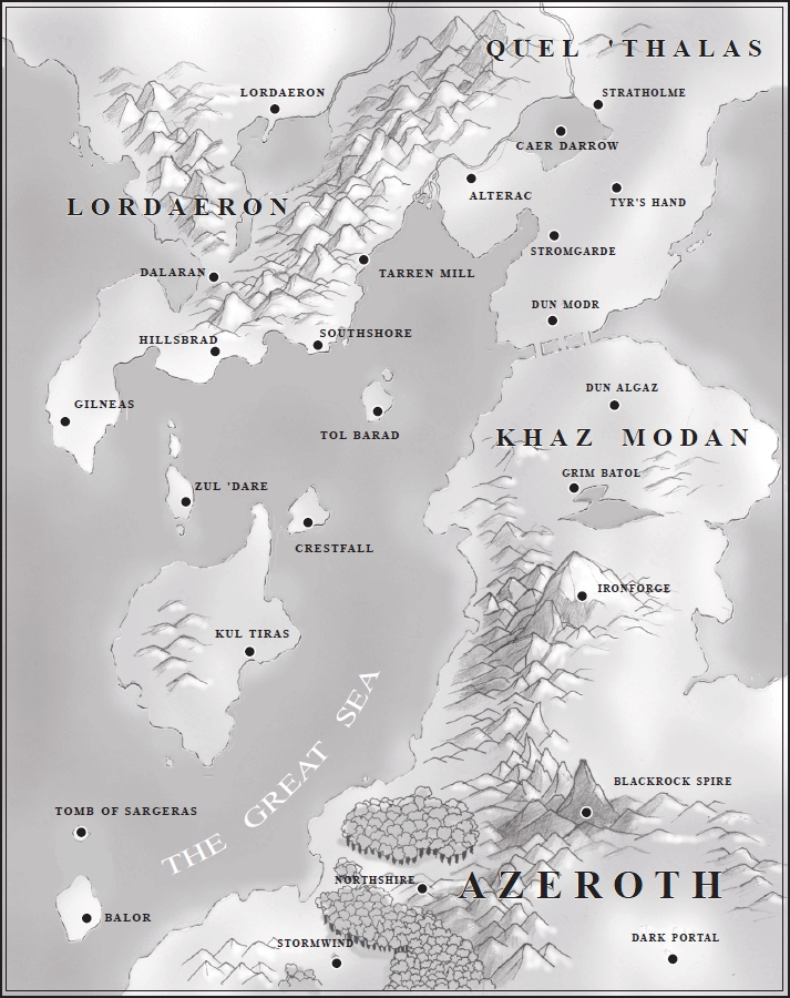 | 713 × 900 (426 KB) | Xporc (talk | contribs) | ||
| 16:05, 14 March 2007 |  | 490 × 616 (58 KB) | Curse1 (talk | contribs) | == Summary == Reverted to earlier revision |
You cannot overwrite this file.
File usage
The following 23 pages use this file:
- Alterac (kingdom)
- Balor
- Baradin Bay
- Broken Isles
- Caer Darrow
- Channel Islands
- Crestfall
- Darrowmere River
- Eastern Kingdoms
- Great Sea
- Kul Tiras
- Maps
- Ruins of Alterac
- Ruins of Gilneas
- Stromgarde (kingdom)
- Stu Rose
- Tyr's Hand
- Warcraft II: Tides of Darkness manual
- Zone ideas
- Talk:Dalaran
- Talk:Hasic
- Talk:Stormwind City
- User:Hurax25275/Tol Barad