Category:Coordinate-safe digsite maps
Jump to navigation
Jump to search
This category contains zone maps of dig sites.
Media in category "Coordinate-safe digsite maps"
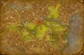
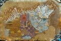
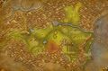
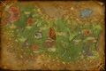
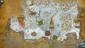
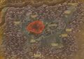
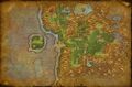
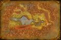
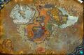
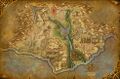
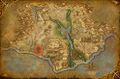
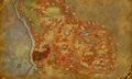
The following 97 files are in this category, out of 97 total.
 Agol'watha Digsite map.jpg 973 × 638; 139 KB
 Altar of Quetz'lun Digsite map.jpg 985 × 650; 154 KB
 Altar of Sseratus Digsite map.jpg 978 × 650; 160 KB
 Altar of Zul Digsite map.jpg 912 × 603; 125 KB
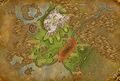
 Ashenvale digsites.jpg 1,002 × 668; 327 KB
 Azshara digsites.jpg 1,002 × 668; 332 KB
 Bael Modan Digsite map.jpg 422 × 566; 57 KB
 Blasted Lands digsites.jpg 1,002 × 668; 320 KB
 Bleeding Hollow Ruins Digsite map.jpg 805 × 596; 98 KB
 Bonechewer Ruins Digsite map.jpg 727 × 629; 93 KB
 Broken Commons Digsite map.jpg 960 × 649; 127 KB
 Broken Pillar Digsite map.jpg 351 × 423; 35 KB
 Burning Blade Digsite map.jpg 849 × 574; 99 KB
 Cape of Stranglethorn digsites.jpg 1,002 × 668; 322 KB
 Coilskar Point Digsite map.jpg 783 × 612; 101 KB
 Crystalsong Forest digsites.jpg 1,002 × 668; 334 KB
 Darkmist Ruins Digsite Map.jpg 720 × 480; 106 KB
 Darkshore digsites.jpg 1,002 × 668; 271 KB
 Dire Maul Digsite map.jpg 945 × 614; 121 KB
 Duskwood digsites.jpg 1,002 × 668; 312 KB
 East Auchindoun Digsite map.jpg 720 × 480; 102 KB
 Eastern Ruins of Thaurissan digsite map.jpg 863 × 523; 94 KB
 Eastern Zul'Mamwe Digsite map.jpg 995 × 660; 155 KB
 Eastmoon Ruins Digsite map.jpg 447 × 534; 58 KB
 Eclipse Point Digsite map.jpg 766 × 545; 91 KB
 En'kilah Digsite map.jpg 984 × 643; 162 KB
 Felwood digsites.jpg 1,002 × 668; 298 KB
 Grangol'var Village Digsite map.jpg 1,001 × 666; 134 KB
 Halaa Digsite map.jpg 769 × 567; 90 KB
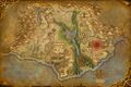
 Hellfire Basin Digsite map.jpg 991 × 643; 121 KB
 Hillsbrad Foothills digsites.jpg 1,002 × 668; 216 KB
 Infectis Scar Fossil Field map.jpg 982 × 648; 138 KB
 Jintha'Alor Lower City Digsite map.jpg 1,036 × 832; 256 KB
 Jintha'Alor Upper City Digsite map.jpg 820 × 582; 114 KB
 Jotunheim Digsite map.jpg 964 × 636; 133 KB
 Khartut's Tomb Digsite map.jpg 976 × 632; 140 KB
 Kodo Graveyard digsite map.jpg 980 × 653; 144 KB
 Kolramas Digsite map.jpg 994 × 600; 146 KB
 Lake Kel'Theril Digsite map.jpg 987 × 652; 154 KB
 Loch Modan digsites.jpg 1,002 × 668; 273 KB
 Mannoroc Coven Digsite map.jpg 980 × 662; 147 KB
 Marshlands Fossil Bank map.jpg 968 × 634; 120 KB
 Misty Reed Fossil Bank digsite map.jpg 813 × 543; 97 KB
 Moonrest Gardens Digsite map.jpg 688 × 384; 68 KB
 Northridge Fossil Field digsite map.jpg 700 × 577; 94 KB
 Oneiros Digsite map.jpg 1,001 × 670; 136 KB
 Pit of Narjun Digsite map.jpg 671 × 379; 67 KB
 Pyrox Flats Digsite map.jpg 809 × 564; 94 KB
 Ravenwind Digsite map.jpg 1,000 × 662; 138 KB
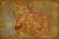
 Redridge Mountains digsites.jpg 1,002 × 668; 295 KB
 Riplash Ruins Digsite map.jpg 996 × 659; 170 KB
 Ruins of Ahmtul Digsite map.jpg 980 × 642; 143 KB
 Ruins of Ammon Digsite map.jpg 992 × 652; 146 KB
 Ruins of Eldre'thar digsite map.jpg 959 × 574; 117 KB
 Ruins of Farahlon Digsite map.jpg 991 × 655; 137 KB
 Ruins of Khintaset Digsite map.jpg 991 × 652; 146 KB
 Ruins of Solarsal Digsite Map.jpg 720 × 480; 106 KB
 Sanctuary of Malorne Digsite map.jpg 965 × 639; 126 KB
 Sargeron digsite map.jpg 685 × 655; 108 KB
 Savage Coast Raptor Fields map.jpg 991 × 650; 151 KB
 Scourgeholme Digsite map.jpg 689 × 423; 65 KB
 Screaming Reaches Fossil Field digsite map.jpg 683 × 561; 77 KB
 Sha'naar Digsite map.jpg 902 × 515; 91 KB
 Shield Hill Digsite map.jpg 976 × 637; 157 KB
 Silithus digsites.jpg 1,002 × 668; 293 KB
 Skorn Digsite map.jpg 978 × 649; 160 KB
 Slitherblade Shore Digsite map.jpg 1,001 × 662; 149 KB
 South Isildien Digsite map.jpg 992 × 660; 134 KB
 Southshore Fossil Field digsite map.jpg 921 × 620; 130 KB
 Steps of Fate Digsite map.jpg 978 × 654; 148 KB
 Stonetalon Peak digsite map.jpg 965 × 636; 129 KB
 Storm Peaks digsites.jpg 1,002 × 668; 355 KB
 Sunken Temple Digsite map.jpg 928 × 577; 118 KB
 Sunspring Post Digsite map.jpg 997 × 665; 131 KB
 Temple of Uldum Digsite map.jpg 974 × 651; 144 KB
 Terror Run Fossil Field map.jpg 991 × 570; 110 KB
 Terror Wing Fossil Field.jpg 1,024 × 768; 259 KB
 Thoradin's Wall digsite map.jpg 826 × 630; 115 KB
 Tomb of the Watchers Digsite map.jpg 984 × 649; 133 KB
 Tombs of the Precursors Digsite map.jpg 987 × 650; 147 KB
 Tuurem Digsite map.jpg 713 × 615; 90 KB
 Uldaman Entrance Digsite map.jpg 953 × 618; 124 KB
 Unearthed Grounds digsite map.jpg 982 × 656; 134 KB
 Valley of Bones digsite map.jpg 990 × 656; 146 KB
 Voldrune Digsite map.jpg 983 × 646; 146 KB
 Warden's Cage Digsite map.jpg 762 × 604; 99 KB
 West Auchindoun Digsite map.jpg 724 × 641; 95 KB
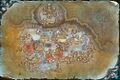
 Witherbark Village Digsite map.jpg 1,251 × 787; 278 KB
 Wyrmbog Fossil Field digsite map.jpg 616 × 556; 79 KB
 Wyrmskull Digsite map.jpg 982 × 650; 161 KB
 Ymirheim Digsite map.jpg 689 × 428; 66 KB
 Zangarmarsh digsites.jpg 1,002 × 668; 332 KB
 Zeth'Gor Digsite map.jpg 899 × 581; 103 KB
 Ziata'jai Digsite map.jpg 916 × 578; 129 KB
 Zim'Rhuk Digsite map.jpg 954 × 574; 134 KB
 Zol'Heb Digsite map.jpg 978 × 650; 157 KB
 Zul'Mashar Digsite map.jpg 923 × 613; 126 KB


