File:Tyrs Bay Tyrs Hand Warcraft II map.jpg
Jump to navigation
Jump to search


No higher resolution available.
Tyrs_Bay_Tyrs_Hand_Warcraft_II_map.jpg (282 × 212 pixels, file size: 21 KB, MIME type: image/jpeg)
Summary
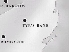
A crop of the Eastern Kingdoms' map showing the eastern coast of Lordaeron, south of Darrowmere Lake. (Tyr's Hand and Stromgarde's locations were moved by the time of World of Warcraft.)
Licensing
This image was taken from Warcraft II: Tides of Darkness, Warcraft II: Beyond the Dark Portal, the manuals, and/or official bonus maps.
File history
Click on a date/time to view the file as it appeared at that time.
| Date/Time | Thumbnail | Dimensions | User | Comment | |
|---|---|---|---|---|---|
| current | 19:16, 5 October 2023 | | 282 × 212 (21 KB) | Goldskullb (talk | contribs) |
You cannot overwrite this file.
File usage
The following page uses this file: